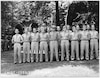
 | HIST-135-003 | R.O.T.C. (Perry); 07/26/1949 |
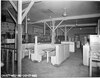
 | HIST-045-001 | PX; 10/17/1946 |
 | HIST-045-002 | PX; 10/17/1946 |
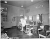 | HIST-045-003 | PX; 10/17/1946 |
 | HIST-045-004 | PX; 10/17/1946 |
 | HIST-045-005 | PX; 10/17/1946 |
 | HIST-045-006 | PX; 10/17/1946 |
 | HIST-045-007 | PX; 10/17/1946 |
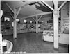
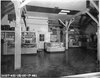
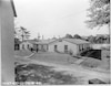 | HIST-043-001 | PX and Rec. Bldg; 10/15/1946 |
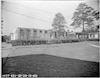 | HIST-043-002 | PX and Rec. Bldg; 10/15/1946 |
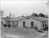 | HIST-043-003 | PX and Rec. Bldg; 10/15/1946 |
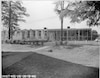 | HIST-043-004 | PX and Rec. Bldg; 10/15/1946 |
 | HIST-308-001 | Progress views of construction; 02/24/1955 |
 | HIST-312-001 | Progress shots of construction; 03/02/1955 |
 | HIST-139-002 | Presentation of antiquarian maps on 28 March 1950 from Sir Edward Travis (via John Tiltman) to DIRAFSA, Rear Admiral Stone (NCS); Tiltman and Captain Harper looking at the maps; 3/28/1950 |